The V-map System keeps surveyors out of dangerous and hazardous environments such as busy highways, mining pits, and unstable terrain, thereby effectively improving the safe execution of your projects. By integrating the V-map System with high resolution sensors, you will be able to deliver highly accurate and detailed maps from which volumes can be calculated, contours and elevations extracted, 3D models generated (with software) and more! In addition the V-map System saves time and costs by eliminating the need for ground control surveys. Here are few of the applications in which the V-map system excels in improving profitability, safety and efficiency:
High Resolution, High Precision 3D Modeling
Example Environment(s):
- Urban and Peri-Urban environments in which placing and capturing ground control points between densely grouped buildings or vertical structures can be difficult, time consuming and even hazardous;
- Highways, Motorways, Roadways, Railways, Bridges, other
Advantages of using the V-map system:
- No lives put in dangerous situations
- No need to place ground control in locations where either
- a) Long occupations of marked points with GPS are needed to fix the GCP position
- b) Likelihood of getting sufficient coverage of the GCP in the overlapping photography may be questionable.
Construction & Volumetrics
Example Environment(s):
- Mines, Gravel pits, Stock Pile sites
- Lumber Yards
- General Earth Works
- Construction sites
Advantages of using the V-map system:
- No lives put in dangerous situations
- Faster turn around times from crew deployment to deliverable
- High resolution and high accuracy products allow for far more accurate volume calculations than traditional methods
Precision Agriculture
Example Environment(s):
- Small Private Farms
- Commercial Farming Operations
- Forestry
- Ecological Monitoring
- Environmental Assessments and Restoration Projects
Advantages of using the V-map system:
- No need to spend time avoiding walking on crops to place Ground Control Points in the fields
- Combining V-map with Multi-Spectral and Infra-red sensors allows you to map locations of a single plant with centimeter precision.
- Ability to precisely identify problem locations without needing to survey them conventionally.
- High resolution and high accuracy products allow for better field/crop management as well as for ecological monitoring.
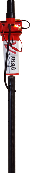
- V-map can also be used on a survey rod for ground based surveys, replacing the need to purchase additional expensive equipment for such applications.
Precise Sensor Geo-Referencing
Example Environment(s):
- You name them!
Advantages of using the V-map system:
- PPS (Pulse Per Second) Output for precise timing
- NMEA Output (Optional) allowing for cameras that accept NMEA input to be directly connected.
- Precisely Geo-reference Imagery (Infra-red, Multispectral, Hyper Spectral etc).
- Lightweight
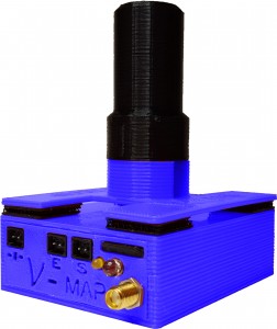
A Complete Solution
In addition to being an ideal solution for increasing the efficiency, accuracy and profitability of your UAS mapping missions, the V-map System is equally suitable, accurate and effective for ground based GPS work.
Simply mounting the 20Hz Geodetic Grade Dual Frequency L1/L2 GPS V-map System to a survey rod with a compatible camera gives you the ability to survey checkpoints accurately and document them with photographs. Use your camera instead of an expensive data-logger!